

Nobody transcribes a field book at 6pm. Yours builds itself in the field.
ZiaMap is the hub for land survey operations: GPS-tagged photos and a chronological Field Journal, signed on site and synced to the office. Built by a surveyor with 30 years in the field.
Built for every survey type.
From day-to-day boundary work to high-precision specialty types, organized by project.
ALTA / NSPS
Capture every condition required for ALTA/NSPS standards without a separate notebook.
Boundary
Record monuments, encroachments, and corner conditions with location-verified photos and notes.
Construction
Document stakeouts, restakes, and field changes tied to the project and the day.
Topographic
Pair photos and notes with terrain features as your crew walks the site.
As-built
Documented conditions ready for the as-built deliverable. No transcription step.
Any specialty
Custom field codes, an NSPS reference library, and project-level organization for anything else.
See the hours your crew loses to end-of-day paperwork.
Return trips, photo admin, note cleanup after dark. Put in your firm's numbers and see what it costs you in a year. No signup to see it.
Built for surveyors.
The mobile app captures the way field crews actually work: for sun, dirt, and one free hand.
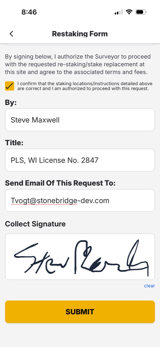
Signed on site. Off your desk before the office opens.
A day in the field, documented as it happens.
One boundary survey on a Tuesday, from the first monument to the drive home.
The first monument gets photographed, not sketched. Pinned to the exact coordinate, stamped with the time, with a short note riding along.
Every corner, every encroachment, every fence that crosses where it should not. Photo, location, note. The Field Journal builds itself in order.
A restake request comes in on the construction side. The crew processes it on site and the inspector signs on the phone. The office has the signed ticket.
No coverage in the back half. Does not matter. ZiaMap holds everything on the device and syncs the moment a signal comes back.
The crew leaves. The office already has every photo, note, and signature, organized by project. Nobody transcribes a field book at 6pm.
Field documentation, answered.
The one your crew will actually use with gloves on. ZiaMap is built for survey crews: GPS-tagged photos, structured notes, and a chronological Field Journal, captured on the phone already in their pocket and synced automatically.
Yes. It captures the same observations, monuments, conditions, and ties, then adds the location, the timestamp, and the crew member automatically. Nothing to transcribe, nothing to lose to weather.
Yes. Crews capture everything offline. Photos, notes, and signatures hold on the device and sync the moment a signal comes back.
ALTA/NSPS, boundary, construction, topographic, and as-built work, plus any specialty through custom field codes and the NSPS reference library, organized by project.
Automatically. When the crew has signal, every photo, note, and signature syncs to the office, organized by project. No data entry step, no manual hand-off.
Yes. Per-firm pricing, no enterprise contracts, no multi-year lock-in, and nothing to learn that does not help in the field.
Built for surveyors. Built by one.
Early access is open and 100% free to use.